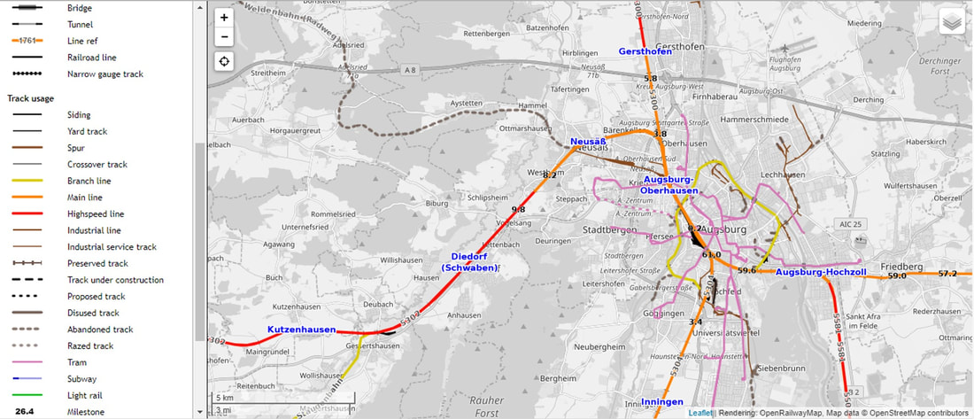
This website may not have the detail of Google Maps or Google Earth, but it is specifically designed for tracking (no pun intended) down railway lines. Below is a screen grab of the area around Augsburg, Germany. Note the legend at the left that provides detailed information on the types of lines via color coding in the map. The most useful, disused and abandoned lines, help railfans avoid camping out at locations where the change of seeing a train pass are, well, zero.
The next time you take a trip to Europe that allows for some railfanning, be sure to check out OpenRailwayMap.org before you go. You just might find a new favorite railfanning location!


 RSS Feed